Introduction: When a fire ignites, first responders need to act quickly to not only put out the fire, but also contain the spread.
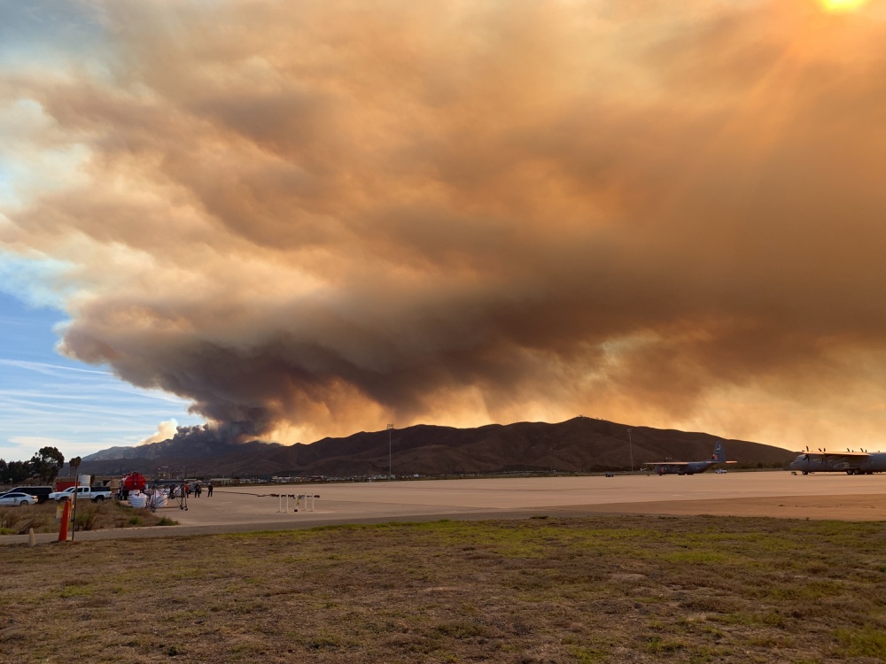
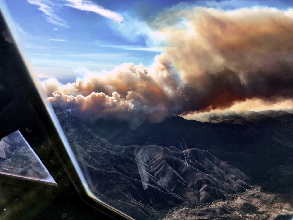
In November of 2018, wildfires engulfed the state of California, with the deadliest and most destructive fires it ever experienced. Close to 75,000 people had to evacuate due to the Camp and Woolsey fires. Approximately 12,000 buildings and residences were destroyed and damaged. Over 65 fatalities were reported, a number likely to rise due to people being unaccounted for.
Challenges: Due to first responders being dispersed within California, All Partners Access Network (apan.org) is relied upon by the California Military Department (CMD) to provide near real-time updates and information to Federal, State, Local, Tribal and NGOs in an effort to combat the wildfires in California.
To ensure cooperation and coordination was taking place, CMD invited those supporting the disaster response into their APAN community, including California Department of Forestry and Fire Protection (CAL FIRE) and California’s Pacific Gas and Electric (PG&E). PG&E needed a way to track their field operators.
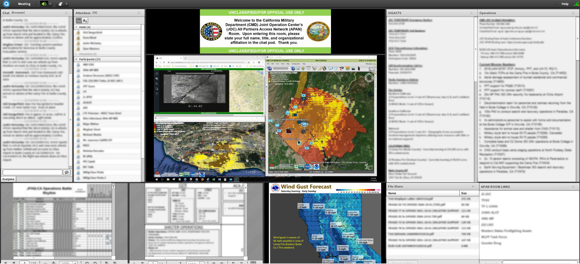
Solutions: The California Military Department is utilizing APAN to provide coordinated information through 9 Adobe Connect conference rooms.
In one of the rooms, PG&E is working with CMD to track their field operators who are in the field making repairs to electric grids.
“With any response, interagency collaboration is monumental and without APAN, our response and operations will be severely degraded.” Stephan Brown, Operations NCOIC, JOC, JFHQ California Military Department. November 16, 2018.
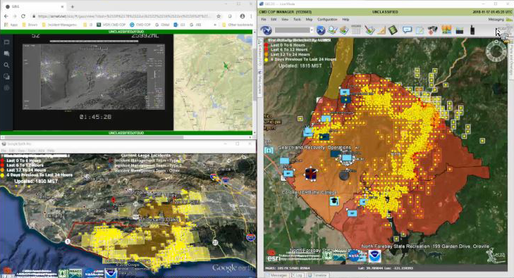
Results: Using data-feeds in Adobe Connect, various teams working the fires are able to synchronize efforts and capabilities.
Damage assessments to homes and buildings are monitored, as well as shelter capacities. Links to weather forecasts to identify potential wind gusts are displayed to assist those on the ground be prepared for varied response. Flight statuses of all air-frames involved in response, maintenance schedules for rotation, and capabilities remaining at flight facilities spread over California are shared for enhanced situational awareness. On-the-ground coordination across several geographic areas provide real-time position locations in relation to satellite hot-spot detection for life-safety assurance while cutting fire containment lines occurs. With assistance from Law Enforcement agencies, CMD assists in the monitoring of evacuation zones and road closures to route vehicles accordingly.
Overall, the CMD common operating picture on All Partners Access Network assists many agencies and first responders to identify necessary information within one location. An APAN community like the California Wild Fire Response allows for coordinated, quick response.
Overall, the CMD common operating picture on All Partners Access Network assists many agencies and first responders to identify necessary information within one location. An APAN community like the California Wild Fire Response allows for coordinated, quick response.